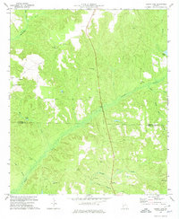
1972 Map of County Line
USGS Topo · Published 1974About this map
Pataula Creek and its many tributaries, including Beaver Creek and Little Creek, carve through the rural landscape along the boundary of Stewart and Randolph counties. This early 1970s survey documents a network of small, dispersed communities and ecclesiastical centers such as Benevolence, Pumpkin Town, and Scienceville. The density of country churches and their associated burial grounds, including Philadelphia Church and Mt Zion Church, provides a clear view of the social and genealogical fabric of this Georgia interior. Cultural history is visible in landmarks like the Indian Mounds and Griers Cave, while industrial activity is represented by a Quarry and gaging station. The presence of Wards Mill Branch suggests the lingering sites of earlier water-powered industry, set against a backdrop of small ponds like Singer Pond and Carters Pond.
Find a feature on this map
32 named features on this map. Tap any name to fly to it.
Don’t see what you’re looking for? This feature index may not catch every label — zoom into the map to look around manually.
Map Details
Editions of this 1972 County Line Map
This is the sole edition of this map. No revisions or reprints were ever made.
Other maps of this area

1950 · Lumpkin
USGS Topo · 1:24,000

1950 · Lumpkin SW
USGS Topo · 1:24,000

1950 · Lumpkin
USGS Topo · 1:62,500

1953 · Dothan
USGS Topo · 1:250,000

1954 · Dothan
USGS Topo · 1:250,000

1955 · Dothan
USGS Topo · 1:250,000

1955 · Lumpkin
USGS Topo · 1:24,000

1955 · Lumpkin SW
USGS Topo · 1:24,000

1955 · Lumpkin
USGS Topo · 1:62,500

1955 · Phenix City
USGS Topo · 1:250,000