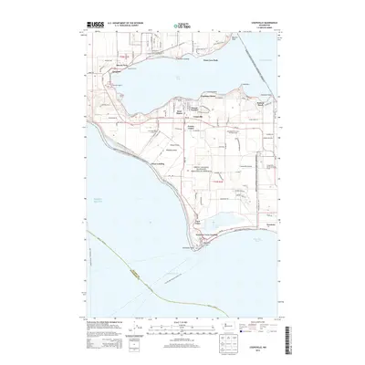
2014 Map of Coupeville
USGS Topo · Published 2014About this map
Whidbey Island dominates this 2014 survey, illustrating a landscape defined by its maritime heritage and military history. The town of Coupeville serves as a central hub, flanked by the residential developments of Sunset Terrace and Dean Manor. To the south, the Ebeys Landing National Historical Reserve preserves the rural character of Ebeys Prairie and Smith Prairie, where the long-established Sunnyside Cem sits near Prairie Center. The coastline is marked by significant landmarks including Admiralty Head and the historic grounds of Fort Casey, which overlook Admiralty Inlet. Transportation is vital to this island community, with the Keystone Ferry Landing providing a critical link across the water at Keystone. Small settlements like San de Fuca and Coveland line the shores of Penn Cove, reflecting a settlement pattern deeply tied to the natural harbors and sheltered waters of Puget Sound.
Find a feature on this map
119 named features on this map. Tap any name to fly to it.
Don’t see what you’re looking for? This feature index may not catch every label — zoom into the map to look around manually.
Map Details
Editions of this 2014 Coupeville Map
This is the sole edition of this map. No revisions or reprints were ever made.
Other maps of this area

1939 · Port Townsend
USGS Topo · 1:62,500

1939 · Coupeville
USGS Topo · 1:62,500

1943 · Richardson
USGS Topo · 1:62,500

1943 · Deception Pass
USGS Topo · 1:62,500

1951 · Deception Pass
USGS Topo · 1:62,500

1953 · Coupeville
USGS Topo · 1:24,000

1953 · Freeland
USGS Topo · 1:24,000

1953 · Nordland
USGS Topo · 1:24,000

1953 · Camano
USGS Topo · 1:24,000

1953 · Port Townsend North
USGS Topo · 1:24,000