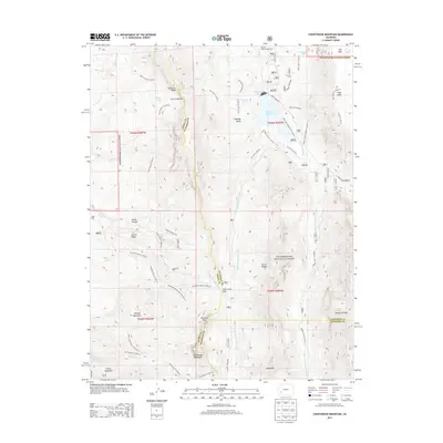
2013 Map of Courthouse Mountain
USGS Topo · Published 2013About this map
Courthouse Mountain and the jagged Cimarron Ridge dominate this high-altitude landscape where the borders of Ouray, Gunnison, and Hinsdale counties converge. This 2013 survey captures the complex drainage of the W Fork Cimarron River and its impact on the local geography, particularly at the Silver Jack Reservoir and the accompanying Silver Jack Dam. The area is a nexus of seasonal transit and forest management within the Uncompahgre National Forest, defined by significant gaps like Owl Creek Pass and Lou Creek Pass. Notable landmarks such as Chimney Rock and Turret Ridge serve as primary navigational points for the extensive trail network, including the Old Owl Creek Trl 6236.0 and the Jackson Guard Station Trl 6225.1A, illustrating how 21st-century conservation and recreation maintain the footprints of historic mountain travel.
Find a feature on this map
59 named features on this map. Tap any name to fly to it.
Don’t see what you’re looking for? This feature index may not catch every label — zoom into the map to look around manually.
Map Details
Editions of this 2013 Courthouse Mountain Map
This is the sole edition of this map. No revisions or reprints were ever made.
Other maps of this area

1902 · Ouray
USGS Topo · 1:62,500

1903 · Lake City
USGS Topo · 1:62,500

1904 · Ouray
USGS Topo · 1:62,500

1905 · Lake City
USGS Topo · 1:62,500

1908 · Uncompahgre
USGS Topo · 1:125,000

1909 · Montrose
USGS Topo · 1:125,000

1911 · Uncompahgre
USGS Topo · 1:125,000

1911 · Montrose
USGS Topo · 1:125,000

1955 · Ouray
USGS Topo · 1:24,000

1956 · Montrose
USGS Topo · 1:250,000