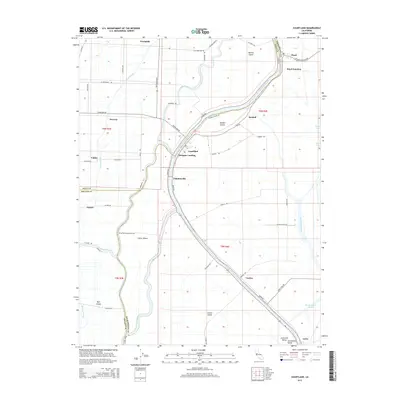
2015 Map of Courtland
USGS Topo · Published 2015About this map
The Sacramento River defines the geography of this Sacramento Valley region, where its winding path creates a series of large river islands and intricate waterways. This landscape is shaped by the complex network of Steamboat Slough, Sutter Slough, and Elk Slough, which separate landmasses such as Grand Island and Sutter Island. Small riverfront settlements like Courtland, Paintersville, and Morgans Landing line the eastern bank, reflecting the area's long-standing reliance on the river for transport and irrigation.
Find a feature on this map
69 named features on this map. Tap any name to fly to it.
Don’t see what you’re looking for? This feature index may not catch every label — zoom into the map to look around manually.
Map Details
Editions of this 2015 Courtland Map
This is the sole edition of this map. No revisions or reprints were ever made.
Other maps of this area

1894 · Lodi
USGS Topo · 1:125,000

1908 · Courtland
USGS Topo · 1:62,500

1909 · Florin
USGS Topo · 1:31,680

1910 · New Hope
USGS Topo · 1:31,680

1910 · Rio Vista
USGS Topo · 1:31,680

1910 · Bruceville
USGS Topo · 1:31,680

1910 · Isleton
USGS Topo · 1:31,680

1916 · Cache Slough
USGS Topo · 1:31,680

1916 · Vorden
USGS Topo · 1:31,680
1916 · Babel Slough
USGS Topo · 1:31,680