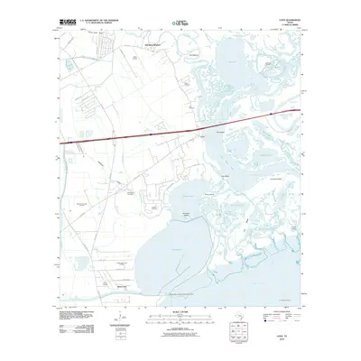
2010 Map of Cove
USGS Topo · Published 2010About this map
Old River-Winfree and Beach City anchor this coastal landscape where the Trinity River delta meets Trinity Bay. This 2010 survey reveals an environment defined by complex hydrology, from the meandering Old River and The Cutoff to expansive water bodies like Dutton Lake and Lost Lake. The mapping of several family-named burial sites, including Tilton Cemetery, Icet Cemetery, and Montgomery Cemetery, provides vital ground-truth data for genealogists and local historians tracking early settlers in this part of Harris County.
Find a feature on this map
72 named features on this map. Tap any name to fly to it.
Don’t see what you’re looking for? This feature index may not catch every label — zoom into the map to look around manually.
Map Details
Editions of this 2010 Cove Map
This is the sole edition of this map. No revisions or reprints were ever made.
Other maps of this area

1916 · Morgan Point
USGS Topo · 1:24,000

1916 · Cedar Bayou
USGS Topo · 1:24,000

1919 · Morgan Point
USGS Topo · 1:31,680

1919 · Cedar Bayou
USGS Topo · 1:31,680

1942 · Anahuac
USGS Topo · 1:24,000

1943 · West of Eagle
USGS Topo · 1:31,680
1943 · Morgan Point
USGS Topo · 1:31,680

1943 · Cedar Bayou
USGS Topo · 1:24,000

1950 · Houston
USGS Topo · 1:250,000
1956 · Morgan Point
USGS Topo · 1:24,000