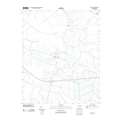
2010 Map of Cove City
USGS Topo · Published 2010About this map
Cove City serves as the central hub of this eastern North Carolina landscape, where the local economy is anchored by the Cove City Post Office and a network of roads named for prominent local families. The town's layout is defined by the intersection of Trenton Rd and N Main St, with residential corridors like White Ave and Brown Ave extending through the settlement. To the north, smaller communities such as Wintergreen and Perfection dot the rural expanse, connected by winding routes like Wintergreen Rd.
Find a feature on this map
32 named features on this map. Tap any name to fly to it.
Don’t see what you’re looking for? This feature index may not catch every label — zoom into the map to look around manually.
Map Details
Editions of this 2010 Cove City Map
This is the sole edition of this map. No revisions or reprints were ever made.
Other maps of this area

1901 · New Bern
USGS Topo · 1:62,500

1902 · Ayden
USGS Topo · 1:62,500

1902 · Vanceboro
USGS Topo · 1:62,500

1903 · New Bern
USGS Topo · 1:62,500

1903 · Trent River
USGS Topo · 1:62,500

1904 · Ayden
USGS Topo · 1:62,500

1904 · Trent River
USGS Topo · 1:62,500

1904 · Vanceboro
USGS Topo · 1:62,500

1905 · Vanceboro
USGS Topo · 1:62,500

1950 · Pollocksville
USGS Topo · 1:24,000