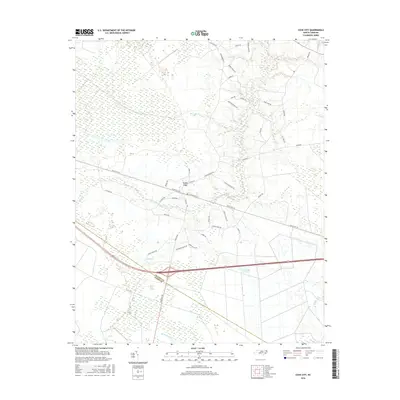
2016 Map of Cove City
USGS Topo · Published 2016About this map
Cove City serves as the central hub of this coastal plain landscape, situated along the historic corridor of Old US Hwy 70. The topography is dominated by the sprawling Great Dover Swamp, a low-lying wetland system that dictates the placement of local infrastructure and agriculture. Waterways like Core Creek, Mill Br, and Grape Cr define the drainage patterns of the region, while the border between Craven County and Jones County cuts through the southern reaches of the swamp. Numerous local roads, including McCoy Cemetary Rd, Koonce Town Rd, and Heath Swamp Rd, suggest a landscape deeply tied to family names and rural homesteads. The transition from the developed streets of the town center, such as W Sunset Blvd and N Main St, to the dense wetlands illustrates the enduring influence of the coastal environment on North Carolina's interior settlements.
Find a feature on this map
42 named features on this map. Tap any name to fly to it.
Don’t see what you’re looking for? This feature index may not catch every label — zoom into the map to look around manually.
Map Details
Editions of this 2016 Cove City Map
This is the sole edition of this map. No revisions or reprints were ever made.
Other maps of this area

1901 · New Bern
USGS Topo · 1:62,500

1902 · Ayden
USGS Topo · 1:62,500

1902 · Vanceboro
USGS Topo · 1:62,500

1903 · New Bern
USGS Topo · 1:62,500

1903 · Trent River
USGS Topo · 1:62,500

1904 · Ayden
USGS Topo · 1:62,500

1904 · Trent River
USGS Topo · 1:62,500

1904 · Vanceboro
USGS Topo · 1:62,500

1905 · Vanceboro
USGS Topo · 1:62,500

1950 · Pollocksville
USGS Topo · 1:24,000