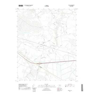
2019 Map of Cove City
USGS Topo · Published 2019About this map
Cove City serves as the central hub of this eastern North Carolina landscape, where a grid of town streets like W Sunset Blvd and S Main St meets the rural agricultural lands of Craven and Jones Counties. The geography is defined by a dense network of watercourses and wetlands, most notably the expansive Great Dover Swamp to the west. This lowland environment is threaded with numerous creeks, including Core Creek, Grape Cr, and Rollins Cr, which dictate the placement of roads and farm boundaries. The map reflects a deeply rooted local history through family-named thoroughfares such as McCoy Cemetary Rd, Cicero Riggs Rd, and John Daugherty Rd. These labels offer significant genealogical clues, tying specific families to the roads and drainages of the region near the headwaters of Musselshell Cr and Mill Br.
Find a feature on this map
41 named features on this map. Tap any name to fly to it.
Don’t see what you’re looking for? This feature index may not catch every label — zoom into the map to look around manually.
Map Details
Editions of this 2019 Cove City Map
This is the sole edition of this map. No revisions or reprints were ever made.
Other maps of this area

1901 · New Bern
USGS Topo · 1:62,500

1902 · Ayden
USGS Topo · 1:62,500

1902 · Vanceboro
USGS Topo · 1:62,500

1903 · New Bern
USGS Topo · 1:62,500

1903 · Trent River
USGS Topo · 1:62,500

1904 · Ayden
USGS Topo · 1:62,500

1904 · Trent River
USGS Topo · 1:62,500

1904 · Vanceboro
USGS Topo · 1:62,500

1905 · Vanceboro
USGS Topo · 1:62,500

1950 · Pollocksville
USGS Topo · 1:24,000