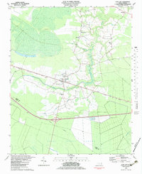
1982 Map of Cove City
USGS Topo · Published 1983About this map
Cove City serves as a central hub for this portion of eastern North Carolina, situated along the Atlantic and East Carolina railroad. The landscape is defined by the expansive Great Dover Swamp to the south and west, where an indefinite boundary separates Craven and Jones counties. This environment, characterized by low-lying wetlands and sluggish watercourses like Musselshell Creek and Core Creek, dictated a settlement pattern concentrated on the slightly higher ground of the northern and eastern reaches.
Find a feature on this map
19 named features on this map. Tap any name to fly to it.
Don’t see what you’re looking for? This feature index may not catch every label — zoom into the map to look around manually.
Map Details
Editions of this 1982 Cove City Map
This is the sole edition of this map. No revisions or reprints were ever made.
Other maps of this area

1901 · New Bern
USGS Topo · 1:62,500

1902 · Ayden
USGS Topo · 1:62,500

1902 · Vanceboro
USGS Topo · 1:62,500

1903 · New Bern
USGS Topo · 1:62,500

1903 · Trent River
USGS Topo · 1:62,500

1904 · Ayden
USGS Topo · 1:62,500

1904 · Trent River
USGS Topo · 1:62,500

1904 · Vanceboro
USGS Topo · 1:62,500

1905 · Vanceboro
USGS Topo · 1:62,500

1950 · Pollocksville
USGS Topo · 1:24,000