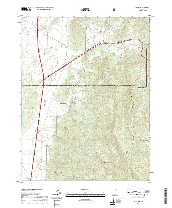
2023 Map of Cove Fort
USGS Topo · Published 2023About this map
Sulphurdale serves as the primary focal point of this 2023 survey, situated at the intersection of industry and the natural landscape where the Tushar Mountains meet the Pahvant Range. The area is characterized by geothermal and mineral activity, evidenced by the Geothermal Plant Road and several springs such as North Spring and South Spring. Much of the eastern terrain falls within the Fishlake National Forest, a region marked by steep canyons like Bear Canyon and Snow Canyon.
Find a feature on this map
31 named features on this map. Tap any name to fly to it.
Don’t see what you’re looking for? This feature index may not catch every label — zoom into the map to look around manually.
Map Details
Editions of this 2023 Cove Fort Map
This is the sole edition of this map. No revisions or reprints were ever made.
Other maps of this area

1885 · Beaver
USGS Topo · 1:250,000

1932 · Sevier
USGS Topo · 1:62,500

1935 · Sevier
USGS Topo · 1:62,500

1937 · Delano Peak
USGS Topo · 1:48,000

1943 · Delano Peak
USGS Topo · 1:62,500

1953 · Richfield
USGS Topo · 1:250,000

1954 · Beaver NE
USGS Topo · 1:24,000

1958 · Richfield
USGS Topo · 1:250,000

1958 · Beaver
USGS Topo · 1:62,500

1962 · Cove Fort
USGS Topo · 1:62,500