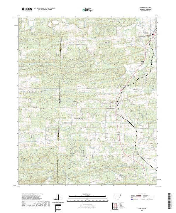
2024 Map of Cove
USGS Topo · Published 2024About this map
The Oklahoma Arkansas state line bisects this landscape, separating McCurtain County and Polk County. Within the Arkansas territory, the town of Cove and the settlement of Hatfield serve as the primary hubs along the north-south transit corridor. To the west, the more remote reaches of Plunketville sit near the state border, surrounded by a dense network of mountain streams including the Mountain Fork and Sixmile Creek. The map reveals a deeply rooted rural community, evidenced by several scattered burial grounds such as Buffalo Cem, Westview Cem, and Cecil Chapel Cem. These sites, along with the tellingly named Welcome Home Rd, suggest a long-standing settlement pattern defined by small family holdings and rugged drainage basins like those of Buffalo Creek and Panther Creek.
Find a feature on this map
85 named features on this map. Tap any name to fly to it.
Don’t see what you’re looking for? This feature index may not catch every label — zoom into the map to look around manually.
Map Details
Editions of this 2024 Cove Map
This is the sole edition of this map. No revisions or reprints were ever made.
Other maps of this area

1890 · Poteau Mountain
USGS Topo · 1:125,000

1899 · Poteau Mountain
USGS Topo · 1:125,000

1900 · Winding Stair
USGS Topo · 1:125,000

1902 · Lukfata
USGS Topo · 1:125,000

1909 · Winding Stair
USGS Topo · 1:125,000

1913 · De Queen
USGS Topo · 1:125,000

1950 · Mcalester
USGS Topo · 1:250,000

1958 · Potter
USGS Topo · 1:62,500

1958 · Zafra
USGS Topo · 1:24,000
1958 · Potter
USGS Topo · 1:24,000