
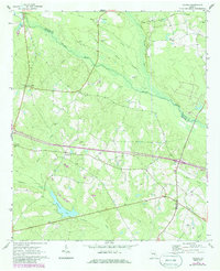
1970 Map of Covena
USGS Topo · Published 1973About this map
Covena and the small settlements of Norristown and Gillis Springs anchor this portion of the rural Georgia coastal plain, situated along the border of Emanuel and Treutlen counties. The landscape is defined by the winding course of the Ohoopee River and its many tributaries, including Spring Branch, Reedy Creek, and Pendleton Creek, which feeds into Wildwood Lake. Evidence of the region's former infrastructure is visible in the Old Railroad Grade running through the northern sector. The map serves as a detailed record of local genealogy and community life, marking numerous rural sanctuaries like Thigpen Chapel, Holtons Chapel, and Boiling Springs Ch. Family history is deeply rooted in the land here, indicated by widely scattered burial sites such as Wilkes Cem, Stewart Cem, and the solitary Phillips Grave.
Find a feature on this map
35 named features on this map. Tap any name to fly to it.
Don’t see what you’re looking for? This feature index may not catch every label — zoom into the map to look around manually.
Map Details
Editions of this 1970 Covena Map
2 editions found
Other maps of this area

1957 · Macon
USGS Topo · 1:250,000

1958 · Macon
USGS Topo · 1:250,000

1964 · Macon
USGS Topo · 1:250,000

1970 · Oak Park SW
USGS Topo · 1:24,000

1970 · Nunez
USGS Topo · 1:24,000

1970 · Oak Park
USGS Topo · 1:24,000

1971 · Norristown
USGS Topo · 1:24,000

1971 · Swainsboro
USGS Topo · 1:24,000

1971 · Soperton South
USGS Topo · 1:24,000

1971 · Soperton North
USGS Topo · 1:24,000