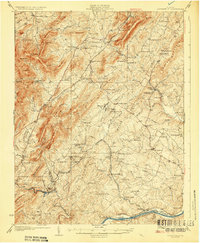
1929 Map of Covesville
USGS Topo · Published 1929About this map
Albemarle Soapstone Company operations anchor this 1920s landscape, illustrating the specialized quarrying industry that shaped central Virginia south of Charlottesville. The map captures the infrastructure of the era, from the Southern Railway passing through Covesville and North Garden to the Chesapeake and Ohio line following the James River through Scottsville. This survey preserves a dense network of early 20th-century rural life, including numerous family-named landmarks like Heard Mtn and Butler Mountain.
Find a feature on this map
121 named features on this map. Tap any name to fly to it.
Don’t see what you’re looking for? This feature index may not catch every label — zoom into the map to look around manually.
Map Details
Editions of this 1929 Covesville Map
Other maps of this area

1891 · Palmyra
USGS Topo · 1:125,000

1892 · Buckingham
USGS Topo · 1:125,000

1892 · Gordonsville
USGS Topo · 1:125,000

1892 · Harrisonburg
USGS Topo · 1:125,000

1895 · Palmyra
USGS Topo · 1:125,000

1897 · Palmyra
USGS Topo · 1:125,000

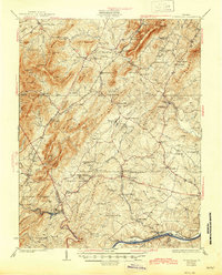
1929 · Covesville
USGS Topo · 1:62,500

1931 · University
USGS Topo · 1:62,500

1934 · Waynesboro
USGS Topo · 1:48,000

1935 · Charlottesville
USGS Topo · 1:62,500