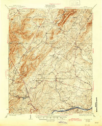
1929 Map of Covesville
USGS Topo · Published 1945About this map
The Albemarle Soapstone Company and the quarrying operations at Alberene anchor the industrial landscape of southern Albemarle County during this interwar period. The terrain is defined by the sharp ridges of the Fan Mountains and Appleberry Mountain, where local commerce followed the narrow valleys and gaps like Israel Gap. Transport is dominated by the Southern and Chesapeake and Ohio railroads, which linked mountain settlements like Batesville and Covesville to the river port at Scottsville on the James River.
Find a feature on this map
129 named features on this map. Tap any name to fly to it.
Don’t see what you’re looking for? This feature index may not catch every label — zoom into the map to look around manually.
Map Details
Editions of this 1929 Covesville Map
Other maps of this area

1891 · Palmyra
USGS Topo · 1:125,000

1892 · Buckingham
USGS Topo · 1:125,000

1892 · Gordonsville
USGS Topo · 1:125,000

1892 · Harrisonburg
USGS Topo · 1:125,000

1895 · Palmyra
USGS Topo · 1:125,000

1897 · Palmyra
USGS Topo · 1:125,000

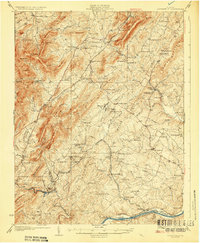
1929 · Covesville
USGS Topo · 1:62,500

1931 · University
USGS Topo · 1:62,500

1934 · Waynesboro
USGS Topo · 1:48,000

1935 · Charlottesville
USGS Topo · 1:62,500