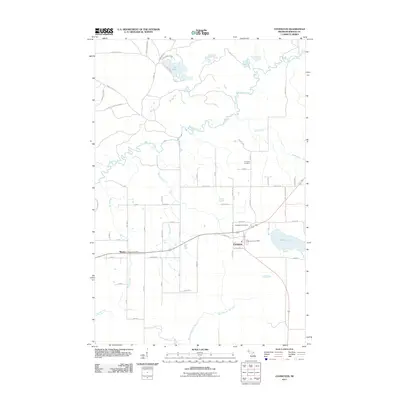
2011 Map of Covington
USGS Topo · Published 2011About this map
Covington and the nearby village of Watton anchor this Baraga County survey, centered around the intersection of modern transit and historical settlement. The landscape is defined by the winding course of the Sturgeon River as it flows toward Tibbetts Falls and the vast Big Lake in the north. This 2011 map reflects a region of the Upper Peninsula where family legacy is deeply etched into the geography, evidenced by numerous roads and locations named for local residents like Nurmela, Kauranen, and Marttila Rd.
Find a feature on this map
63 named features on this map. Tap any name to fly to it.
Don’t see what you’re looking for? This feature index may not catch every label — zoom into the map to look around manually.
Map Details
Editions of this 2011 Covington Map
This is the sole edition of this map. No revisions or reprints were ever made.
Other maps of this area

1895 · Ned Lake
USGS Topo · 1:62,500

1895 · Perch Lake
USGS Topo · 1:62,500

1954 · Perch Lake
USGS Topo · 1:62,500

1954 · Sidnaw
USGS Topo · 1:62,500

1955 · Ned Lake
USGS Topo · 1:62,500

1955 · Herman
USGS Topo · 1:62,500

1958 · Iron River
USGS Topo · 1:250,000

1960 · Iron River
USGS Topo · 1:250,000

1961 · Iron River
USGS Topo · 1:250,000

1967 · Iron River
USGS Topo · 1:250,000