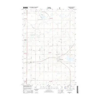
2014 Map of Covington
USGS Topo · Published 2014About this map
Covington and the neighboring settlement of Watton anchor this survey of the Baraga County highlands. The landscape is defined by the extensive Ottawa National Forest, which covers much of the northwestern terrain and is traversed by the N Country National Scenic Trail. Water features are prominent throughout, from the larger basin of Big Lake in the north to Worm Lake in the east. The Sturgeon River flows through the forest, notably passing Tibbetts Falls, while the southern reaches are drained by the W Br Net River. Local infrastructure is marked by a network of family-named timber and forest roads, such as Syrjala Rd and Nurmela Rd, which branch off the primary corridor of Us-141. The local Covington Cem appears in two locations, reflecting the distributed nature of this rural community.
Find a feature on this map
74 named features on this map. Tap any name to fly to it.
Don’t see what you’re looking for? This feature index may not catch every label — zoom into the map to look around manually.
Map Details
Editions of this 2014 Covington Map
This is the sole edition of this map. No revisions or reprints were ever made.
Other maps of this area

1895 · Ned Lake
USGS Topo · 1:62,500

1895 · Perch Lake
USGS Topo · 1:62,500

1954 · Perch Lake
USGS Topo · 1:62,500

1954 · Sidnaw
USGS Topo · 1:62,500

1955 · Ned Lake
USGS Topo · 1:62,500

1955 · Herman
USGS Topo · 1:62,500

1958 · Iron River
USGS Topo · 1:250,000

1960 · Iron River
USGS Topo · 1:250,000

1961 · Iron River
USGS Topo · 1:250,000

1967 · Iron River
USGS Topo · 1:250,000