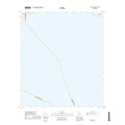
2018 Map of Covington SW
USGS Topo · Published 2018About this map
Lake Pontchartrain dominates this 2018 survey, which focuses primarily on the open waters where several parish boundaries converge. This specific section of the lake serves as a geographic junction point where the borders of Tangipahoa Parish and St. Tammany Parish meet. Further south, the map delineates the shared boundary of Tangipahoa Parish and St. John the Baptist Parish, illustrating how these administrative divisions are projected across the water. Produced by the U.S. Geological Survey, the map provides a precise look at the township and range lines, such as t8s r10e and t8s r11e, as they intersect with the shoreline and the lake's expanse. For those studying the political geography of the region, it offers a clear view of how these maritime borders are officially recorded.
Find a feature on this map
11 named features on this map. Tap any name to fly to it.
Don’t see what you’re looking for? This feature index may not catch every label — zoom into the map to look around manually.
Map Details
Editions of this 2018 Covington SW Map
This is the sole edition of this map. No revisions or reprints were ever made.
Other maps of this area

1891 · Spanish Fort
USGS Topo · 1:62,500

1892 · Bonnet Carre
USGS Topo · 1:62,500

1935 · Covington
USGS Topo · 1:62,500

1935 · Ponchatoula
USGS Topo · 1:62,500

1936 · Bonnet Carre
USGS Topo · 1:62,500

1936 · Spanish Fort
USGS Topo · 1:62,500

1939 · Ponchatoula
USGS Topo · 1:62,500

1939 · Covington
USGS Topo · 1:62,500

1950 · Covington
USGS Topo · 1:62,500

1951 · Ponchatoula
USGS Topo · 1:62,500