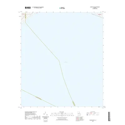
2020 Map of Covington SW
USGS Topo · Published 2020About this map
Lake Pontchartrain dominates this 2020 aquatic survey, which captures the open water where three Louisiana parishes converge. The map is primarily a cartographic study of maritime boundaries, illustrating the precise lines where St. Tammany Parish, Tangipahoa Parish, and St. John the Baptist Parish meet in the middle of the basin. This perspective is vital for understanding regional jurisdiction over the lake's waters and the transition from the marshy shoreline in the north to the deep open water that defines this corner of the Gulf Coast region. Because the map focuses on the water, it highlights the intersection of Public Land Survey System designations such as t8s r9e and t8s r11e, providing a clear view of the underwater legal geography often missed on terrestrial sheets.
Find a feature on this map
6 named features on this map. Tap any name to fly to it.
Don’t see what you’re looking for? This feature index may not catch every label — zoom into the map to look around manually.
Map Details
Editions of this 2020 Covington SW Map
This is the sole edition of this map. No revisions or reprints were ever made.
Other maps of this area

1891 · Spanish Fort
USGS Topo · 1:62,500

1892 · Bonnet Carre
USGS Topo · 1:62,500

1935 · Covington
USGS Topo · 1:62,500

1935 · Ponchatoula
USGS Topo · 1:62,500

1936 · Bonnet Carre
USGS Topo · 1:62,500

1936 · Spanish Fort
USGS Topo · 1:62,500

1939 · Ponchatoula
USGS Topo · 1:62,500

1939 · Covington
USGS Topo · 1:62,500

1950 · Covington
USGS Topo · 1:62,500

1951 · Ponchatoula
USGS Topo · 1:62,500