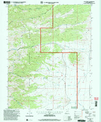
2002 Map of Cow Creek
USGS Topo · Published 2005About this map
Dixie National Forest dominates this high-altitude landscape in Garfield County, centered on the steep slopes of Mount Dutton. The drainage patterns here are complex, with waters flowing from high springs like Mountain Spring and Beebe Spring into the westward-running canyons of Cow Creek and Cottonwood Creek. To the east, the terrain breaks into the broad expanse of Johns Valley, where the Sevier River flows northward through the Powell Ranger District. The survey captures a moment in the early 2000s when the land was primarily managed for timber and grazing, evidenced by the network of 4wd tracks and the small Corral near the valley floor. Researchers can trace the sophisticated water management for ranching and forest health through sites like Mountain Spring Reservoir.
Find a feature on this map
40 named features on this map. Tap any name to fly to it.
Don’t see what you’re looking for? This feature index may not catch every label — zoom into the map to look around manually.
Map Details
Editions of this 2002 Cow Creek Map
This is the sole edition of this map. No revisions or reprints were ever made.
Other maps of this area

1885 · Beaver
USGS Topo · 1:250,000

1885 · Fish Lake
USGS Topo · 1:250,000

1886 · Kanab
USGS Topo · 1:250,000

1886 · Escalante
USGS Topo · 1:250,000

1896 · Fish Lake
USGS Topo · 1:250,000

1953 · Richfield
USGS Topo · 1:250,000

1953 · Cedar City
USGS Topo · 1:250,000

1956 · Escalante
USGS Topo · 1:250,000

1956 · Salina
USGS Topo · 1:250,000

1958 · Richfield
USGS Topo · 1:250,000