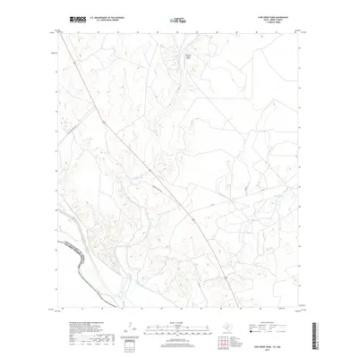
2019 Map of Cow Creek Tank
USGS Topo · Published 2019About this map
The Rio Grande forms a prominent international boundary in this borderlands region of Kinney County, dividing the United States from Mexico. The terrain is defined by a series of drainages and seasonal water features, including Pinto Creek, Isleta Cr, and Goat Cr, which flow toward the river through an arid landscape. Local land use is characterized by large-scale ranching and aviation infrastructure, notably the Rio Pinto Ranch Airport in the northern section. Historical ranching footprints are evident in the naming of rural routes such as Bill Moody Ranch Rd and Roebucks Ranch Rd. Water management for livestock is a visible priority across the quadrangle, marked by scattered catchment features like Cow Cr Tank and Arrow Tank situated along the winding course of Cow Cr.
Find a feature on this map
15 named features on this map. Tap any name to fly to it.
Don’t see what you’re looking for? This feature index may not catch every label — zoom into the map to look around manually.
Map Details
Editions of this 2019 Cow Creek Tank Map
This is the sole edition of this map. No revisions or reprints were ever made.
Other maps of this area

1941 · Standart
USGS Topo · 1:62,500

1941 · Tequesquite Creek
USGS Topo · 1:62,500

1943 · Standart
USGS Topo · 1:62,500

1943 · Del Rio
USGS Topo · 1:62,500

1944 · Sycamore Ranch
USGS Topo · 1:62,500

1944 · Tequesquite Creek
USGS Topo · 1:62,500

1958 · Del Rio
USGS Topo · 1:250,000

1964 · Del Rio
USGS Topo · 1:250,000

1972 · Del Rio SE
USGS Topo · 1:24,000
1978 · Mud Creek South
USGS Topo · 1:24,000