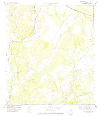
1978 Map of Mud Creek South
USGS Topo · Published 1978About this map
Amanda sits as a quiet rail point in the northeast corner of this Southwest Texas landscape, situated along the Southern Pacific tracks. The terrain is defined by the convergence of several major drainages, including Sycamore Creek, Mud Creek, and Pinto Creek, which carve through the dry scrubland. A prominent Val Verde Co Kinney Co boundary line runs through the western portion of the map, following the winding course of the Sycamore. This 1970s survey illustrates a rural ranching and transport corridor where water sources like Mud Creek Tank and various wells were critical infrastructure. Traces of local activity appear in the form of a Landing Strip, a Radio Tower, and several fords where tracks cross the creek beds, reflecting a landscape where movement was still dictated by the natural seasonal flow of the waterways.
Find a feature on this map
16 named features on this map. Tap any name to fly to it.
Don’t see what you’re looking for? This feature index may not catch every label — zoom into the map to look around manually.
Map Details
Editions of this 1978 Mud Creek South Map
This is the sole edition of this map. No revisions or reprints were ever made.
Other maps of this area

1941 · Standart
USGS Topo · 1:62,500

1941 · Tequesquite Creek
USGS Topo · 1:62,500

1943 · Standart
USGS Topo · 1:62,500

1943 · Del Rio
USGS Topo · 1:62,500

1944 · Sycamore Ranch
USGS Topo · 1:62,500

1944 · Tequesquite Creek
USGS Topo · 1:62,500

1958 · Del Rio
USGS Topo · 1:250,000

1964 · Del Rio
USGS Topo · 1:250,000

1972 · Del Rio SE
USGS Topo · 1:24,000
1972 · Del Rio NE
USGS Topo · 1:24,000