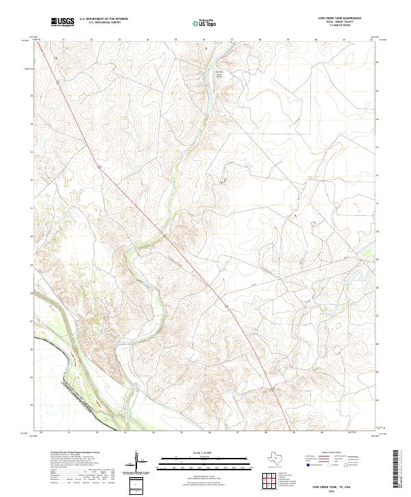
2022 Map of Cow Creek Tank
USGS Topo · Published 2022About this map
The international boundary between the United States and Mexico cuts across the southwestern corner of this Kinney County landscape, where the arid brushland is defined by a network of seasonal watercourses. Pinto Creek meanders through the central valley, joined by tributaries like Derramadero Cr and Goat Cr. The rangeland is organized around water management for livestock, evidenced by features such as Cow Cr Tank and Arrow Tank in the eastern sector. Human activity is sparse and concentrated along transportation corridors like Roebucks Ranch Rd and the prominent Highway 277, which provides the primary transit route through the region. The Rio Pinto Ranch Airport stands as a lonely landmark in the northern reaches, serving the private ranching interests that dominate this borderland territory.
Find a feature on this map
15 named features on this map. Tap any name to fly to it.
Don’t see what you’re looking for? This feature index may not catch every label — zoom into the map to look around manually.
Map Details
Editions of this 2022 Cow Creek Tank Map
This is the sole edition of this map. No revisions or reprints were ever made.
Other maps of this area

1941 · Standart
USGS Topo · 1:62,500

1941 · Tequesquite Creek
USGS Topo · 1:62,500

1943 · Standart
USGS Topo · 1:62,500

1943 · Del Rio
USGS Topo · 1:62,500

1944 · Sycamore Ranch
USGS Topo · 1:62,500

1944 · Tequesquite Creek
USGS Topo · 1:62,500

1958 · Del Rio
USGS Topo · 1:250,000

1964 · Del Rio
USGS Topo · 1:250,000

1972 · Del Rio SE
USGS Topo · 1:24,000
1978 · Mud Creek South
USGS Topo · 1:24,000