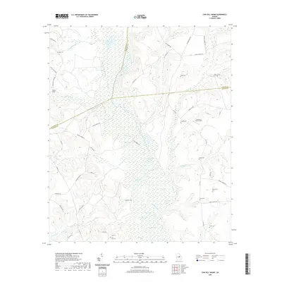
2020 Map of Cow Hell Swamp
USGS Topo · Published 2020About this map
The Oconee River carves a complex course through this corner of Middle Georgia, defining the borders between Wilkinson, Johnson, and Laurens counties. The river valley is a sprawling network of wetlands and oxbows, most notably Cow Hell Swamp and Beaverdam Swamp, interspersed with cutoff channels like Yorks Dead River. Small lakes such as Tobe Lake and Wynn Lake pockmark the floodplain, while elevated ground like Tuckers Flat provides stable footing in the marshy interior.
Find a feature on this map
68 named features on this map. Tap any name to fly to it.
Don’t see what you’re looking for? This feature index may not catch every label — zoom into the map to look around manually.
Map Details
Editions of this 2020 Cow Hell Swamp Map
This is the sole edition of this map. No revisions or reprints were ever made.
Other maps of this area

1916 · Irwinton
USGS Topo · 1:62,500

1920 · Irwinton
USGS Topo · 1:62,500

1957 · Macon
USGS Topo · 1:250,000

1958 · Macon
USGS Topo · 1:250,000

1962 · Oconee
USGS Topo · 1:24,000

1962 · Irwins Crossroads
USGS Topo · 1:24,000

1964 · Macon
USGS Topo · 1:250,000
1973 · Toomsboro
USGS Topo · 1:24,000

1974 · Cow Hell Swamp
USGS Topo · 1:24,000

1974 · Dudley
USGS Topo · 1:24,000