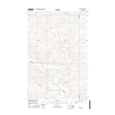
2017 Map of Cow Island
USGS Topo · Published 2017About this map
Cow Island sits as a prominent landform within the winding course of the Missouri River, marking a significant point of interest in this section of the Montana breaks. The landscape is defined by the intersection of several regional watercourses, including Cow Creek, Bull Creek, and the curiously named Kills At Night Creek. This survey captures the complex drainage patterns of the area, where Cabin Creek and Woodhawk Creek carve through the terrain toward the river valley. The map documents the convergence of multiple county lines, illustrating where Blaine County meets both Fergus and Phillips counties along the river's edge. The detailed contouring provides a clear view of the deep coulees and breaks that characterize this stretch of the Missouri, reflecting the area's geography at the start of the 21st century.
Find a feature on this map
10 named features on this map. Tap any name to fly to it.
Don’t see what you’re looking for? This feature index may not catch every label — zoom into the map to look around manually.
Map Details
Editions of this 2017 Cow Island Map
This is the sole edition of this map. No revisions or reprints were ever made.
Other maps of this area

1943 · Landusky
USGS Topo · 1:125,000

1954 · Cow Island
USGS Topo · 1:24,000

1954 · Baker Monument
USGS Topo · 1:24,000

1954 · Sturgeon Island
USGS Topo · 1:24,000

1954 · Grand Island
USGS Topo · 1:24,000

1954 · Lewistown
USGS Topo · 1:250,000

1959 · Lewistown
USGS Topo · 1:250,000

1971 · Crazyman Coulee
USGS Topo · 1:24,000
1971 · John Coulee
USGS Topo · 1:24,000
1971 · Shetland Divide
USGS Topo · 1:24,000