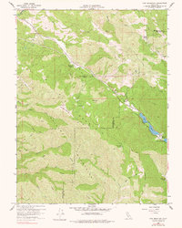
1958 Map of Cow Mountain
USGS Topo · Published 1977About this map
The Mayacmas Mountains and the formidable Cow Mountain Ridge dominate this mid-century landscape along the boundary of Mendocino and Lake Counties. This terrain is characterized by steep slopes and narrow canyons carved by Cold Creek and Scotts Creek, where travel was historically limited to a network of Jeep Trails and Firebreaks. Isolated mountain life is evidenced by family outposts such as Lamb Ranch, Hemlock Ranch, and Cow Mountain Ranch, which were tucked into the high country long before modern infrastructure reached these ridges.
Find a feature on this map
29 named features on this map. Tap any name to fly to it.
Don’t see what you’re looking for? This feature index may not catch every label — zoom into the map to look around manually.
Map Details
Editions of this 1958 Cow Mountain Map
2 editions found

Other maps of this area

1920 · Ukiah
USGS Topo · 1:62,500

1922 · Hullville
USGS Topo · 1:62,500

1938 · Lakeport
USGS Topo · 1:62,500

1943 · Pomo
USGS Topo · 1:62,500

1944 · Ukiah
USGS Topo · 1:62,500

1951 · Lake Pillsbury
USGS Topo · 1:62,500

1951 · Lakeport
USGS Topo · 1:62,500

1957 · Ukiah
USGS Topo · 1:250,000
1958 · Purdys Gardens
USGS Topo · 1:24,000

1958 · Ukiah
USGS Topo · 1:24,000