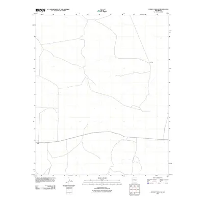
2010 Map of Cowboy Mesa NE
USGS Topo · Published 2010About this map
Lon serves as a primary point of reference in this high-desert portion of Lincoln County during the early 21st century. The landscape is defined by its sparse settlement and an extensive network of rural routes, including County Rd B020 and County Rd B021, which traverse the arid terrain to connect isolated ranchlands and homesites. A rare hydrologic feature, Ditch Lake, is positioned in the northeastern sector, providing a focal point for local water management in an otherwise dry environment. This U.S. Geological Survey topographic study illustrates the persistence of small, named locales like Lon and the critical importance of county infrastructure such as County Rd B048 in maintaining connectivity across the expansive mesa country.
Find a feature on this map
5 named features on this map. Tap any name to fly to it.
Don’t see what you’re looking for? This feature index may not catch every label — zoom into the map to look around manually.
Map Details
Editions of this 2010 Cowboy Mesa NE Map
This is the sole edition of this map. No revisions or reprints were ever made.
Other maps of this area

1954 · Fort Sumner
USGS Topo · 1:250,000

1958 · Fort Sumner
USGS Topo · 1:250,000

1967 · Ramon
USGS Topo · 1:24,000

1967 · Ramon SW
USGS Topo · 1:24,000

1979 · Fort Sumner
USGS Topo · 1:100,000

1980 · Corona
USGS Topo · 1:100,000

1981 · Loco Draw
USGS Topo · 1:24,000

1981 · Cowboy Mesa NE
USGS Topo · 1:24,000

1981 · Gacho Hill SW
USGS Topo · 1:24,000

1981 · Cowboy Mesa SW
USGS Topo · 1:24,000