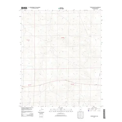
2013 Map of Cowboy Mesa NE
USGS Topo · Published 2013About this map
The settlement of Lon anchors the western edge of this Lincoln County survey, providing a rare point of habitation in a landscape of high-elevation plateaus and drainages. The area is characterized by its organized grid of the Public Land Survey System, spanning townships t1s r17e, t1s r18e, t2s r17e, and t2s r18e. This 2013 topographic study reveals a sparse network of county roads, including Co Road 8048 and Co Road 8021, which navigate the contours of the high desert terrain. Water is a limited and significant resource here, evidenced by the presence of Ditch Lake in the northeastern quadrant. Modern infrastructure is represented by the traverse of Nm-247, which serves as the primary east-west corridor through this open country, connecting the remote reaches of the Cowboy Mesa region.
Find a feature on this map
10 named features on this map. Tap any name to fly to it.
Don’t see what you’re looking for? This feature index may not catch every label — zoom into the map to look around manually.
Map Details
Editions of this 2013 Cowboy Mesa NE Map
This is the sole edition of this map. No revisions or reprints were ever made.
Other maps of this area

1954 · Fort Sumner
USGS Topo · 1:250,000

1958 · Fort Sumner
USGS Topo · 1:250,000

1967 · Ramon
USGS Topo · 1:24,000

1967 · Ramon SW
USGS Topo · 1:24,000

1979 · Fort Sumner
USGS Topo · 1:100,000

1980 · Corona
USGS Topo · 1:100,000

1981 · Loco Draw
USGS Topo · 1:24,000

1981 · Cowboy Mesa NE
USGS Topo · 1:24,000

1981 · Gacho Hill SW
USGS Topo · 1:24,000

1981 · Cowboy Mesa SW
USGS Topo · 1:24,000