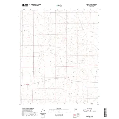
2023 Map of Cowboy Mesa NE
USGS Topo · Published 2023About this map
Lincoln County’s high mesa terrain defines this modern topographic study, characterized by a complex network of public land survey boundaries including t1s r17e, t1s r18e, t2s r17e, and t2s r18e. The landscape is sparse, marked primarily by the winding routes of local county roads that provide the only terrestrial access across the section lines. These thoroughfares, including Co Rd B020 and Co Rd B021, navigate the undulating contours of the Cowboy Mesa region. While the area lacks concentrated settlements, the precise mapping of these rural corridors by the U.S. Geological Survey offers a definitive look at the current infrastructure and land divisions in this part of New Mexico.
Find a feature on this map
7 named features on this map. Tap any name to fly to it.
Don’t see what you’re looking for? This feature index may not catch every label — zoom into the map to look around manually.
Map Details
Editions of this 2023 Cowboy Mesa NE Map
This is the sole edition of this map. No revisions or reprints were ever made.
Other maps of this area

1954 · Fort Sumner
USGS Topo · 1:250,000

1958 · Fort Sumner
USGS Topo · 1:250,000

1967 · Ramon
USGS Topo · 1:24,000

1967 · Ramon SW
USGS Topo · 1:24,000

1979 · Fort Sumner
USGS Topo · 1:100,000

1980 · Corona
USGS Topo · 1:100,000

1981 · Loco Draw
USGS Topo · 1:24,000

1981 · Cowboy Mesa NE
USGS Topo · 1:24,000

1981 · Gacho Hill SW
USGS Topo · 1:24,000

1981 · Cowboy Mesa SW
USGS Topo · 1:24,000