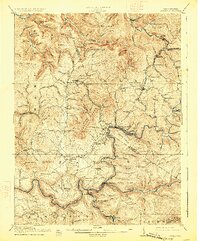
1917 Map of Cowen
USGS Topo · Published 1926About this map
Camden on Gauley and Allingdale serve as central nodes for the timber and rail economy of the central West Virginia highlands during this early 20th-century survey. The landscape is defined by the winding Gauley River and its many tributaries, supporting a dense network of specialized industry including Gauley Mills and various operations along the Baltimore and Ohio RR. The map illustrates a rural society organized around small schoolhouses and creek-side settlements, such as Craigsville and Wainville.
Find a feature on this map
138 named features on this map. Tap any name to fly to it.
Don’t see what you’re looking for? This feature index may not catch every label — zoom into the map to look around manually.
Map Details
Editions of this 1917 Cowen Map
3 editions found

Other maps of this area

1889 · Nicholas
USGS Topo · 1:125,000

1891 · Nicholas
USGS Topo · 1:125,000

1891 · Huntersville
USGS Topo · 1:125,000

1893 · Buckhannon
USGS Topo · 1:125,000

1893 · Sutton
USGS Topo · 1:125,000

1894 · Huntersville
USGS Topo · 1:125,000

1896 · Buckhannon
USGS Topo · 1:125,000

1897 · Buckhannon
USGS Topo · 1:125,000

1901 · Nicholas
USGS Topo · 1:125,000

1908 · Gassaway
USGS Topo · 1:48,000