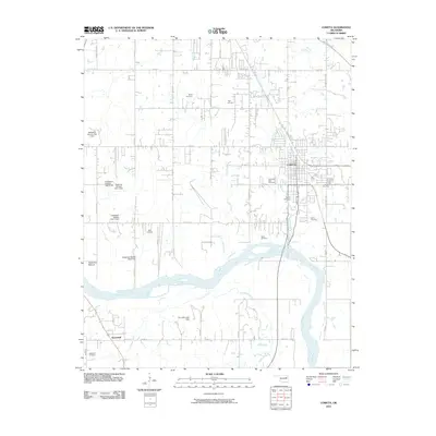
2010 Map of Coweta
USGS Topo · Published 2010About this map
Arkansas River hydrology and family heritage define this portion of Wagoner County. The city of Coweta serves as the primary hub, situated near the Muskogee (P&E) rail line. To the south, the settlement of Stonebluff sits along the riverbanks, where Concharty Creek joins the main channel. The landscape is notable for its high density of family and community burial grounds, including Miller Cemetery, Tiger Cemetery, and the Bird Cemetery, which provide essential touchstones for genealogical research in the region. The western portion of the map is dominated by the Kadashan Bottom terrain, featuring a series of water management structures such as Kadashan Bottom Site 2 Dam and its counterparts. This distribution of small cemeteries and localized drainage projects suggests a long history of rural land division and persistent family ties to the land south of the river.
Find a feature on this map
51 named features on this map. Tap any name to fly to it.
Don’t see what you’re looking for? This feature index may not catch every label — zoom into the map to look around manually.
Map Details
Editions of this 2010 Coweta Map
This is the sole edition of this map. No revisions or reprints were ever made.
Other maps of this area

1896 · Okmulgee
USGS Topo · 1:125,000

1900 · Okmulgee
USGS Topo · 1:125,000

1901 · Claremore
USGS Topo · 1:125,000

1914 · Claremore
USGS Topo · 1:125,000

1916 · Claremore
USGS Topo · 1:125,000

1946 · Fort Smith
USGS Topo · 1:250,000

1954 · Tulsa
USGS Topo · 1:250,000

1955 · Broken Arrow
USGS Topo · 1:24,000

1957 · Leonard
USGS Topo · 1:24,000

1958 · Tulsa
USGS Topo · 1:250,000