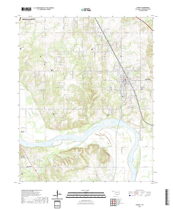
2022 Map of Coweta
USGS Topo · Published 2022About this map
The Arkansas River carves a broad valley through this portion of Wagoner County, separating the agricultural lowlands of Kadashan Bottom from the rising terrain of the Conjada Mountains to the south. This landscape is defined by the transition from the expanding suburban fringes of Broken Arrow in the northwest to the established town center of Coweta in the east. The map reveals a dense network of family and community history, evidenced by numerous small burial grounds such as the Jackson Grove Cem, Shahan Cem, and Tiger Cem that dot the section lines. Modern infrastructure like the Red Baron Ranch Airport sits alongside traditional watercourses including Coweta Creek and Concharty Cr, illustrating the area's evolution from a river-oriented territory to a developed corridor between major Oklahoma hubs. To the south, the settlement of Stonebluff marks a point of higher elevation near the Anderson Cem.
Find a feature on this map
59 named features on this map. Tap any name to fly to it.
Don’t see what you’re looking for? This feature index may not catch every label — zoom into the map to look around manually.
Map Details
Editions of this 2022 Coweta Map
This is the sole edition of this map. No revisions or reprints were ever made.
Other maps of this area

1896 · Okmulgee
USGS Topo · 1:125,000

1900 · Okmulgee
USGS Topo · 1:125,000

1901 · Claremore
USGS Topo · 1:125,000

1914 · Claremore
USGS Topo · 1:125,000

1916 · Claremore
USGS Topo · 1:125,000

1946 · Fort Smith
USGS Topo · 1:250,000

1954 · Tulsa
USGS Topo · 1:250,000

1955 · Broken Arrow
USGS Topo · 1:24,000

1957 · Leonard
USGS Topo · 1:24,000

1958 · Tulsa
USGS Topo · 1:250,000