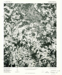
1975 Map of Cowpens NW
USGS Topo · Published 1979About this map
The Broad River winds through the northern portion of this Spartanburg County landscape, revealing the agricultural and forested character of the South Carolina and North Carolina borderlands in the mid-1970s. This orthophotoquad provides an aerial perspective of the rural countryside, where small clusters of settlement like Cooley Springs and Fingerville serve as local hubs for the surrounding farmsteads. The image-based format captures the precise land-use patterns of the era, illustrating the distribution of timbered ridges and cleared fields. To the northeast, the settlement of Harris sits near the river, showing the relationship between early water-access points and the development of crossroads communities. The map serves as a valuable tool for understanding the mid-century spatial arrangement of this Upstate region before modern suburban expansion began to alter the traditional Piedmont landscape.
Find a feature on this map
4 named features on this map. Tap any name to fly to it.
Don’t see what you’re looking for? This feature index may not catch every label — zoom into the map to look around manually.
Map Details
Editions of this 1975 Cowpens NW Map
This is the sole edition of this map. No revisions or reprints were ever made.
Other maps of this area

1907 · Saluda
USGS Topo · 1:125,000

1953 · Charlotte
USGS Topo · 1:250,000

1954 · Charlotte
USGS Topo · 1:250,000

1955 · Knoxville
USGS Topo · 1:250,000

1957 · Knoxville
USGS Topo · 1:250,000

1959 · Lake Lure
USGS Topo · 1:62,500

1959 · Cowpens
USGS Topo · 1:62,500

1960 · Knoxville
USGS Topo · 1:250,000

1960 · Charlotte
USGS Topo · 1:250,000

1961 · Inman
USGS Topo · 1:62,500