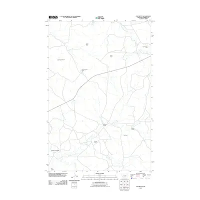
2011 Map of Cox Butte
USGS Topo · Published 2011About this map
Chimney Crossing anchors the southwestern corner of this Garfield County landscape, where the terrain is defined by a series of prominent buttes and complex drainage systems. Named geological features such as Waddington Dome, Neiter Butte, and Thomas Butte rise above the surrounding plains, providing essential landmarks in an area dominated by cattle ranching and open range. The water management of the region is evident in the presence of the Brown Number 3 Dam, a critical piece of infrastructure for local agriculture.
Find a feature on this map
15 named features on this map. Tap any name to fly to it.
Don’t see what you’re looking for? This feature index may not catch every label — zoom into the map to look around manually.
Map Details
Editions of this 2011 Cox Butte Map
This is the sole edition of this map. No revisions or reprints were ever made.
Other maps of this area

1954 · Jordan
USGS Topo · 1:250,000

1954 · Forsyth
USGS Topo · 1:250,000

1956 · Jordan
USGS Topo · 1:250,000

1957 · Forsyth
USGS Topo · 1:250,000

1958 · Jordan
USGS Topo · 1:250,000

1958 · Forsyth
USGS Topo · 1:250,000

1963 · Mc Williams Springs
USGS Topo · 1:24,000
1963 · Dutton Ranch
USGS Topo · 1:24,000

1964 · Jordan
USGS Topo · 1:250,000
1965 · Sand Springs
USGS Topo · 1:24,000