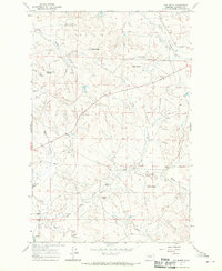
1967 Map of Cox Butte
USGS Topo · Published 1970About this map
Thomas Sch serves as a lone community focal point in this high-plains landscape of central Montana, where the topography is defined by prominent elevations and a complex network of coulees. The terrain is punctuated by significant landmarks such as Neiter Butte, Waddington Dome, and O'Day Butte, while the namesake Cox Butte rises above the Dry Fork of Lodgepole Creek. This 1967 field-checked survey reveals a sparse ranching economy dependent on reliable water access at points like Chimney Crossing on Cat Creek. A web of unimproved dirt roads and selected fence lines connects remote outposts, including the area around the Sand Springs BM 3194 marker. The drainage pattern, featuring Skeleton Creek and the South Fork Lodgepole Creek, illustrates the erosional forces that have carved out named draws like Tuccori Coulee and Hensleigh Coulee.
Find a feature on this map
26 named features on this map. Tap any name to fly to it.
Don’t see what you’re looking for? This feature index may not catch every label — zoom into the map to look around manually.
Map Details
Editions of this 1967 Cox Butte Map
This is the sole edition of this map. No revisions or reprints were ever made.
Other maps of this area

1954 · Jordan
USGS Topo · 1:250,000

1954 · Forsyth
USGS Topo · 1:250,000

1956 · Jordan
USGS Topo · 1:250,000

1957 · Forsyth
USGS Topo · 1:250,000

1958 · Jordan
USGS Topo · 1:250,000

1958 · Forsyth
USGS Topo · 1:250,000

1963 · Mc Williams Springs
USGS Topo · 1:24,000
1963 · Dutton Ranch
USGS Topo · 1:24,000

1964 · Jordan
USGS Topo · 1:250,000
1965 · Sand Springs
USGS Topo · 1:24,000