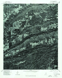
1975 Map of Cox Gap
USGS Topo · Published 1977About this map
Ashville lies within a landscape of striking linear ridges and valleys in this mid-1970s orthophotoquad. Produced by the U.S. Geological Survey in cooperation with the Soil Conservation Service, this imagery-based map provides a raw view of land use and forest cover in St. Clair County. The stark contrast between the wooded slopes and the cleared agricultural plots reveals the traditional rural development patterns of the region. A prominent Creek and its various tributaries cut through the valley floors, dictating the placement of early homesteads and road networks visible in the aerial photography. This specific type of survey, derived from December 1975 flights, offers a precise look at the terrain before modern suburbanization, emphasizing the natural topography that shaped this part of Alabama.
Find a feature on this map
2 named features on this map. Tap any name to fly to it.
Don’t see what you’re looking for? This feature index may not catch every label — zoom into the map to look around manually.
Map Details
Editions of this 1975 Cox Gap Map
This is the sole edition of this map. No revisions or reprints were ever made.
Other maps of this area

1889 · Springville
USGS Topo · 1:125,000

1892 · Springville
USGS Topo · 1:125,000

1947 · Cox Gap
USGS Topo · 1:24,000

1947 · Dunaway Mountain
USGS Topo · 1:24,000

1947 · Ragland
USGS Topo · 1:62,500

1947 · Ragland
USGS Topo · 1:24,000

1947 · Francis Mill
USGS Topo · 1:24,000

1947 · Steele
USGS Topo · 1:24,000

1947 · Steele
USGS Topo · 1:62,500
1949 · Ohatchee
USGS Topo · 1:24,000