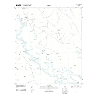
2011 Map of Cox
USGS Topo · Published 2011About this map
Altamaha River meanders through this coastal Georgia landscape, defining a complex network of wetlands, ridges, and historic river landings. The map reveals a long history of river-based transit and settlement, evidenced by Old Fort Barrington and its associated Fort Barrington Landing in the northwest. To the east, the settlement of Cox sits near the headwaters of McClendon Creek, while smaller landings like Browns Lake Landing and Clarks Bluff Landing indicate the vital role of the water for local commerce and access.
Find a feature on this map
87 named features on this map. Tap any name to fly to it.
Don’t see what you’re looking for? This feature index may not catch every label — zoom into the map to look around manually.
Map Details
Editions of this 2011 Cox Map
This is the sole edition of this map. No revisions or reprints were ever made.
Other maps of this area

1918 · Everett City
USGS Topo · 1:62,500

1920 · Sapelo River
USGS Topo · 1:62,500

1920 · Everett City
USGS Topo · 1:62,500

1921 · Darien
USGS Topo · 1:62,500

1943 · Ludowici
USGS Topo · 1:62,500

1943 · Sapelo River
USGS Topo · 1:62,500

1944 · Everett City
USGS Topo · 1:62,500

1945 · Sapelo River
USGS Topo · 1:62,500

1946 · Brunswick
USGS Topo · 1:250,000

1948 · Brunswick
USGS Topo · 1:250,000