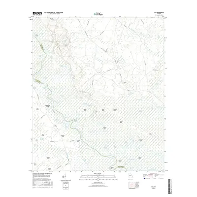
2017 Map of Cox
USGS Topo · Published 2017About this map
The Altamaha River winds through a vast network of wetlands and tidal reaches along the boundary of McIntosh and Glynn counties. This coastal Georgia landscape is defined by its complex hydrology, featuring numerous named oxbows and reaches such as Gamecock Reach and the curiously named Alligator Congress. Small settlements like Cox and Altamaha Park serve as anchors in a territory dominated by expansive tracts of Buffalo Swamp and Chisholm Swamp. High ground is rare, appearing as strategic bluffs like Ballast Bluff, Clarks Bluff, and Halfmoon Bluff, which historically provided vital access points to the river's winding channels. Local history is preserved in several isolated burial grounds, including Plum Orchard Cem and Holland Cem, often situated near older roads like Old River Rd and Barrington Rd.
Find a feature on this map
100 named features on this map. Tap any name to fly to it.
Don’t see what you’re looking for? This feature index may not catch every label — zoom into the map to look around manually.
Map Details
Editions of this 2017 Cox Map
This is the sole edition of this map. No revisions or reprints were ever made.
Other maps of this area

1918 · Everett City
USGS Topo · 1:62,500

1920 · Sapelo River
USGS Topo · 1:62,500

1920 · Everett City
USGS Topo · 1:62,500

1921 · Darien
USGS Topo · 1:62,500

1943 · Ludowici
USGS Topo · 1:62,500

1943 · Sapelo River
USGS Topo · 1:62,500

1944 · Everett City
USGS Topo · 1:62,500

1945 · Sapelo River
USGS Topo · 1:62,500

1946 · Brunswick
USGS Topo · 1:250,000

1948 · Brunswick
USGS Topo · 1:250,000