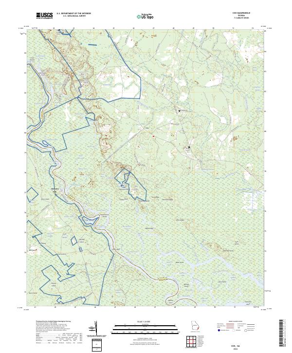
2024 Map of Cox
USGS Topo · Published 2024About this map
The Altamaha River carves a complex course through this coastal Georgia landscape, defining the boundary between Mcintosh Co, Wayne Co, and Glynn Co. This environment is characterized by a dense network of braided channels, sloughs, and named pockets, such as Old Womans Pocket and Alligator Congress. The settlement of Cox serves as a local inland hub, connected by a web of rural routes like Townsend Cox Rd and Possum Point Rd. Along the riverbanks, numerous bluffs and islands appear, including Clarks Bluff, Halfmoon Bluff, and Wernats Island. Genealogists will find the Gardner Poppell Cem and Holland Cem as key points of interest. The area is also notable for its many distinct water bodies like Gamecock Lake and Belly Hole Lake, which suggest a long history of seasonal flooding and changing river paths.
Find a feature on this map
100 named features on this map. Tap any name to fly to it.
Don’t see what you’re looking for? This feature index may not catch every label — zoom into the map to look around manually.
Map Details
Editions of this 2024 Cox Map
This is the sole edition of this map. No revisions or reprints were ever made.
Other maps of this area

1918 · Everett City
USGS Topo · 1:62,500

1920 · Sapelo River
USGS Topo · 1:62,500

1920 · Everett City
USGS Topo · 1:62,500

1921 · Darien
USGS Topo · 1:62,500

1943 · Ludowici
USGS Topo · 1:62,500

1943 · Sapelo River
USGS Topo · 1:62,500

1944 · Everett City
USGS Topo · 1:62,500

1945 · Sapelo River
USGS Topo · 1:62,500

1946 · Brunswick
USGS Topo · 1:250,000

1948 · Brunswick
USGS Topo · 1:250,000