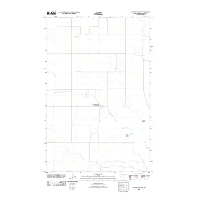
2011 Map of Coyote Coulee
USGS Topo · Published 2011About this map
Schnitzler Ranch sits in the northern reaches of this Roosevelt County landscape, where the high plains are carved by intermittent watercourses and traditional land holdings. The drainage patterns of the region are defined by the winding paths of Smoke Creek and Spring Creek, which traverse the terrain toward the south and east. A significant point of water management on the reservation is the Fort Peck Reservation Number 23 Dam, located centrally along one of the many draws. The map illustrates a transition between open grazing land and the distinct geographical depressions of Coyote Coulee and South Branch Coulee. Further south, the course of Lake Creek meanders through the lower sections of the quadrangle, while Fas 344 provides a primary transportation corridor through this corner of the Brockton District.
Find a feature on this map
8 named features on this map. Tap any name to fly to it.
Don’t see what you’re looking for? This feature index may not catch every label — zoom into the map to look around manually.
Map Details
Editions of this 2011 Coyote Coulee Map
This is the sole edition of this map. No revisions or reprints were ever made.
Other maps of this area

1909 · Smoke Creek
USGS Topo · 1:62,500

1912 · Smoke Creek
USGS Topo · 1:62,500

1914 · Brockton
USGS Topo · 1:62,500

1914 · Homestead
USGS Topo · 1:62,500

1947 · Rocky Point
USGS Topo · 1:24,000

1948 · Rocky Point
USGS Topo · 1:24,000

1948 · Fort Kipp
USGS Topo · 1:24,000

1949 · Fort Kipp
USGS Topo · 1:24,000

1950 · Coyote Coulee
USGS Topo · 1:24,000

1950 · Calais
USGS Topo · 1:24,000