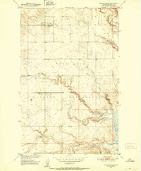
1950 Map of Coyote Coulee
USGS Topo · Published 1952About this map
Fort Peck Indian Reservation lands dominate this mid-century landscape in Roosevelt County, where the topography is defined by intricate drainage networks and coulees. The map details a period of transition within the Missouri River Basin development program, documenting the terrain just after the Second World War. High on the plains, the Schnitzler Ranch stands as a primary point of human settlement amidst the sweeping contours of the northern Missouri valley.
Find a feature on this map
8 named features on this map. Tap any name to fly to it.
Don’t see what you’re looking for? This feature index may not catch every label — zoom into the map to look around manually.
Map Details
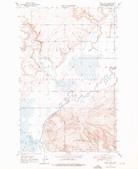
Editions of this 1950 Coyote Coulee Map
2 editions found

Other maps of this area

1909 · Smoke Creek
USGS Topo · 1:62,500

1912 · Smoke Creek
USGS Topo · 1:62,500

1914 · Brockton
USGS Topo · 1:62,500

1914 · Homestead
USGS Topo · 1:62,500
1947 · Rocky Point
USGS Topo · 1:24,000

1948 · Rocky Point
USGS Topo · 1:24,000

1948 · Fort Kipp
USGS Topo · 1:24,000
1949 · Fort Kipp
USGS Topo · 1:24,000
1950 · Calais
USGS Topo · 1:24,000

1954 · Wolf Point
USGS Topo · 1:250,000