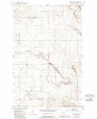
1950 Map of Coyote Coulee
USGS Topo · Published 1989About this map
The Fort Peck Indian Reservation defines much of this landscape, where the Missouri River Basin development project influenced mapping efforts in the late 1940s. The terrain is deeply etched by a network of seasonal watercourses and coulees, most notably the meandering path of Coyote Coulee and its South Branch. These drainage patterns are characteristic of the semi-arid northern plains, showing how water has carved the high benchlands. Local history is anchored by the Schnitzler Ranch in the northern portion of the map, a rare named settlement marker in an area otherwise dominated by topography. Other primary water features including Smoke Creek, Spring Creek, and Lake Creek illustrate the natural irrigation and livestock-watering infrastructure essential to this region of Roosevelt County.
Find a feature on this map
10 named features on this map. Tap any name to fly to it.
Don’t see what you’re looking for? This feature index may not catch every label — zoom into the map to look around manually.
Map Details
Editions of this 1950 Coyote Coulee Map
2 editions found
Other maps of this area

1909 · Smoke Creek
USGS Topo · 1:62,500

1912 · Smoke Creek
USGS Topo · 1:62,500

1914 · Brockton
USGS Topo · 1:62,500

1914 · Homestead
USGS Topo · 1:62,500

1947 · Rocky Point
USGS Topo · 1:24,000

1948 · Rocky Point
USGS Topo · 1:24,000

1948 · Fort Kipp
USGS Topo · 1:24,000

1949 · Fort Kipp
USGS Topo · 1:24,000

1950 · Coyote Coulee
USGS Topo · 1:24,000

1950 · Calais
USGS Topo · 1:24,000