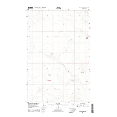
2014 Map of Coyote Coulee
USGS Topo · Published 2014About this map
Coyote Coulee and its associated drainages define this portion of Roosevelt County, Montana, as it appeared in the early 21st century. The landscape is marked by the erosion patterns of the South Branch Coulee and the meandering paths of Spring Cr and Smoke Cr. These seasonal and perennial waterways are critical features in this arid environment, carving out the terrain and dictating the placement of the sparse infrastructure. The northern portion of the map is bisected by MT-344, a primary transportation artery that provides access across the township lines of t30n r53e and t30n r54e. To the south, Lake Cr flows through the lower elevations, highlighting the intricate hydrological network that has shaped the Brockton District. This survey presents a clear look at the Public Land Survey System grid and the natural topography before more recent developments may have altered the area's character.
Find a feature on this map
10 named features on this map. Tap any name to fly to it.
Don’t see what you’re looking for? This feature index may not catch every label — zoom into the map to look around manually.
Map Details
Editions of this 2014 Coyote Coulee Map
This is the sole edition of this map. No revisions or reprints were ever made.
Other maps of this area

1909 · Smoke Creek
USGS Topo · 1:62,500

1912 · Smoke Creek
USGS Topo · 1:62,500

1914 · Brockton
USGS Topo · 1:62,500

1914 · Homestead
USGS Topo · 1:62,500

1947 · Rocky Point
USGS Topo · 1:24,000

1948 · Rocky Point
USGS Topo · 1:24,000

1948 · Fort Kipp
USGS Topo · 1:24,000

1949 · Fort Kipp
USGS Topo · 1:24,000

1950 · Coyote Coulee
USGS Topo · 1:24,000

1950 · Calais
USGS Topo · 1:24,000