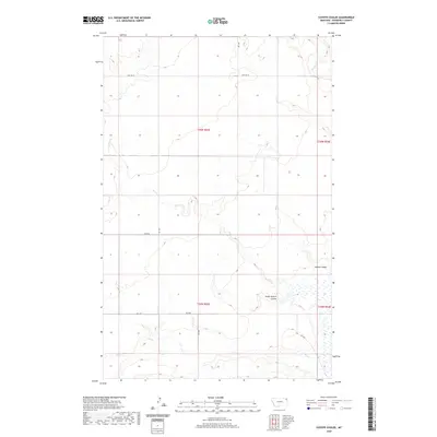
2020 Map of Coyote Coulee
USGS Topo · Published 2020About this map
Coyote Coulee and South Branch Coulee define the drainage patterns of this eastern Montana landscape in Roosevelt County. The area is marked by a network of intermittent waterways, including Smoke Cr, Spring Cr, and Lake Cr, which carve through the high plains. The transition between Township 30 North, Range 53 East and Township 29 North, Range 53 East reveals a classic Western survey grid, where transportation is dictated by section lines and local connectors like Hwy 344 W and Rd 2050. This map illustrates the sparse, high-altitude character of the Missouri River watershed prior to recent infrastructure shifts, showing how the natural coulees and occasional wetlands remain the primary landmarks in an area dominated by cattle ranching and dryland farming traditions.
Find a feature on this map
16 named features on this map. Tap any name to fly to it.
Don’t see what you’re looking for? This feature index may not catch every label — zoom into the map to look around manually.
Map Details
Editions of this 2020 Coyote Coulee Map
This is the sole edition of this map. No revisions or reprints were ever made.
Other maps of this area

1909 · Smoke Creek
USGS Topo · 1:62,500

1912 · Smoke Creek
USGS Topo · 1:62,500

1914 · Brockton
USGS Topo · 1:62,500

1914 · Homestead
USGS Topo · 1:62,500

1947 · Rocky Point
USGS Topo · 1:24,000

1948 · Rocky Point
USGS Topo · 1:24,000

1948 · Fort Kipp
USGS Topo · 1:24,000

1949 · Fort Kipp
USGS Topo · 1:24,000

1950 · Coyote Coulee
USGS Topo · 1:24,000

1950 · Calais
USGS Topo · 1:24,000