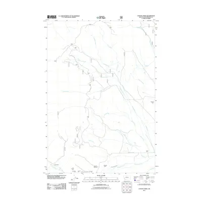
2011 Map of Coyote Creek
USGS Topo · Published 2011About this map
Coyote Creek and its many tributaries, including West Coyote Creek and Lodgepole Creek, carve through this section of Beaverhead County. The landscape is defined by the resource extraction and ranching history of Southwest Montana, with mining activity concentrated near Roberts Gulch in the south. These sites, such as the Monument Mine and Sunshine Mine, represent the region's enduring mineral interest. Transportation in this high-country terrain is limited to rugged corridors like Guard Station Rd and Bloody Dick Rd, which follow the natural drainage patterns of the watershed. Notable landmarks like Stocker Ranch and the ironically named Poverty Flats indicate the sparse but persistent human presence in this area. Water management for agriculture or mining is evident in the Lower Bloody Dick Ditch, while the namesake Bloody Dick Creek flows across the southern portion of the quadrangle.
Find a feature on this map
25 named features on this map. Tap any name to fly to it.
Don’t see what you’re looking for? This feature index may not catch every label — zoom into the map to look around manually.
Map Details
Editions of this 2011 Coyote Creek Map
This is the sole edition of this map. No revisions or reprints were ever made.
Other maps of this area

1955 · Dubois
USGS Topo · 1:250,000

1955 · Dillon
USGS Topo · 1:250,000

1957 · Dillon
USGS Topo · 1:250,000

1958 · Dubois
USGS Topo · 1:250,000

1958 · Dillon
USGS Topo · 1:250,000

1959 · Grant
USGS Topo · 1:62,500

1962 · Dillon
USGS Topo · 1:250,000

1965 · Dillon
USGS Topo · 1:250,000

1965 · Jeff Davis Peak
USGS Topo · 1:24,000

1965 · Lemhi Pass
USGS Topo · 1:24,000