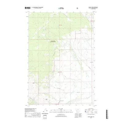
2020 Map of Coyote Creek
USGS Topo · Published 2020About this map
Beaverhead National Forest land dominates this high-country quadrangle in the southwestern corner of Montana. The landscape is defined by an intricate network of drainage systems, where W Coyote Creek and Lodgepole Creek flow through timbered slopes and open basins. The presence of irrigation infrastructure like the Bloody Dick Ditch indicates the historical and ongoing importance of water management in this cattle-ranching region. Evidence of early land use and seasonal habitation is found in the naming of topographical features such as Poverty Flats and several named ravines, including Sullivan Gulch and Roberts Gulch. Remote access is maintained through a small number of forest roads, most notably Guard Station Rd, which winds through the mountain terrain to connect isolated springs like Houlihan Springs with the broader drainage of Bloody Dick Creek.
Find a feature on this map
30 named features on this map. Tap any name to fly to it.
Don’t see what you’re looking for? This feature index may not catch every label — zoom into the map to look around manually.
Map Details
Editions of this 2020 Coyote Creek Map
This is the sole edition of this map. No revisions or reprints were ever made.
Other maps of this area

1955 · Dubois
USGS Topo · 1:250,000

1955 · Dillon
USGS Topo · 1:250,000

1957 · Dillon
USGS Topo · 1:250,000

1958 · Dubois
USGS Topo · 1:250,000

1958 · Dillon
USGS Topo · 1:250,000

1959 · Grant
USGS Topo · 1:62,500

1962 · Dillon
USGS Topo · 1:250,000

1965 · Dillon
USGS Topo · 1:250,000

1965 · Jeff Davis Peak
USGS Topo · 1:24,000

1965 · Lemhi Pass
USGS Topo · 1:24,000