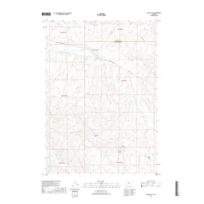
2017 Map of Coyote Hill
USGS Topo · Published 2017About this map
Kirby Cr winds through this arid section of the Bighorn Basin, where the border of Washakie and Hot Springs Counties meets. The landscape is defined by its drainage systems and high points, notably Monument Hill and Coyote Hill. Water remains a central element of the local geography, evidenced by the Kirby Cr Reservoir and several named springs like Malcolm Spring and Brontley Spring. Human activity is sparse but present through the connectivity of Black Mountain Rd and Murphy Dome Rd. The presence of the Rathbun Ranch in the southeast corner suggests the enduring livestock and ranching traditions that characterize this part of Wyoming. Local relief is further detailed by numerous coulees and draws, including Blue Springs Draw and Major Basin Draw.
Find a feature on this map
22 named features on this map. Tap any name to fly to it.
Don’t see what you’re looking for? This feature index may not catch every label — zoom into the map to look around manually.
Map Details
Editions of this 2017 Coyote Hill Map
This is the sole edition of this map. No revisions or reprints were ever made.
Other maps of this area

1945 · Kirby
USGS Topo · 1:62,500

1946 · Kirby
USGS Topo · 1:62,500

1952 · Rathbun Ranch
USGS Topo · 1:24,000

1955 · Thermopolis
USGS Topo · 1:250,000

1955 · Arminto
USGS Topo · 1:250,000

1957 · Rathbun Ranch
USGS Topo · 1:24,000

1958 · Thermopolis
USGS Topo · 1:250,000

1958 · Arminto
USGS Topo · 1:250,000

1960 · Devil Slide
USGS Topo · 1:24,000

1960 · Coyote Hill
USGS Topo · 1:24,000