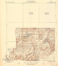
1935 Map of Coyote Hills
USGS Topo · Published 1935About this map
Industrial expansion and citrus agriculture define the borderlands of Orange and Los Angeles counties in the mid-1930s. The landscape is dominated by the Union Oil Tank Farm and the extensive infrastructure of the Union Pacific and Pacific Electric railroads, which facilitated the movement of goods from the surrounding hills. Deep within the Coyote Hills, the sprawling Bastonchury Ranch reflects the era's massive citrus operations, while the presence of the Mexican Sch and Brea-Olinda Union High Sch points to the social fabric of the laboring communities.
Find a feature on this map
33 named features on this map. Tap any name to fly to it.
Don’t see what you’re looking for? This feature index may not catch every label — zoom into the map to look around manually.
Map Details
Editions of this 1935 Coyote Hills Map
2 editions found
Other maps of this area

1894 · Los Angeles
USGS Topo · 1:62,500

1894 · Pomona
USGS Topo · 1:62,500

1896 · Pasadena
USGS Topo · 1:62,500

1896 · Anaheim
USGS Topo · 1:62,500

1896 · Downey
USGS Topo · 1:62,500

1897 · Pomona
USGS Topo · 1:62,500

1898 · Pomona
USGS Topo · 1:62,500

1898 · Anaheim
USGS Topo · 1:62,500

1899 · Downey
USGS Topo · 1:62,500

1900 · Pasadena
USGS Topo · 1:62,500