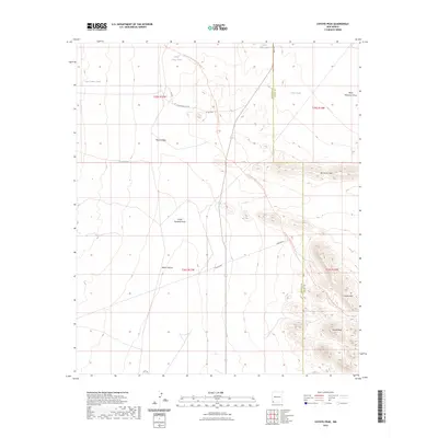
2023 Map of Coyote Peak
USGS Topo · Published 2023About this map
Coyote Peak and the Coyote Hills rise above the high-desert landscape at the boundary of Hidalgo and Grant counties. This Southwestern terrain is defined by its drainage patterns and water management, featuring seasonal watercourses like South Pyramid Draw and Baker Canyon. The importance of water in this arid region is reflected in the distribution of catchments, including Lower Camp Tank, South Tank, and New Coyote Tank.
Find a feature on this map
23 named features on this map. Tap any name to fly to it.
Don’t see what you’re looking for? This feature index may not catch every label — zoom into the map to look around manually.
Map Details
Editions of this 2023 Coyote Peak Map
This is the sole edition of this map. No revisions or reprints were ever made.
Other maps of this area

1918 · Hachita
USGS Topo · 1:62,500

1918 · Playas
USGS Topo · 1:62,500

1919 · Playas
USGS Topo · 1:62,500

1954 · Silver City
USGS Topo · 1:250,000

1955 · Douglas
USGS Topo · 1:250,000

1958 · Silver City
USGS Topo · 1:250,000

1959 · Douglas
USGS Topo · 1:250,000

1961 · Douglas
USGS Topo · 1:250,000

1962 · Silver City
USGS Topo · 1:250,000

1964 · Douglas
USGS Topo · 1:250,000