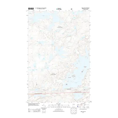
2013 Map of Crab Lake
USGS Topo · Published 2013About this map
Superior National Forest encompasses this intricate northern landscape, where a dense network of glacial lakes and narrow waterways dominates the geography. The map reveals an area defined by its hydrology, centered on the sprawling reaches of Crab Lake and the northern tip of Burntside Lake. To the north, Cummings Lake and Silaca Lake feed into the Korb River, illustrating the interconnected drainage patterns typical of the region.
Find a feature on this map
43 named features on this map. Tap any name to fly to it.
Don’t see what you’re looking for? This feature index may not catch every label — zoom into the map to look around manually.
Map Details
Editions of this 2013 Crab Lake Map
This is the sole edition of this map. No revisions or reprints were ever made.
Other maps of this area

1933 · Ely
USGS Topo · 1:62,500

1939 · Ely
USGS Topo · 1:62,500

1954 · Two Harbors
USGS Topo · 1:250,000

1954 · Hibbing
USGS Topo · 1:250,000

1954 · International Falls
USGS Topo · 1:250,000

1956 · Chad Lake
USGS Topo · 1:24,000
1956 · Soudan
USGS Topo · 1:24,000

1956 · Crab Lake
USGS Topo · 1:24,000

1956 · Eagles Nest
USGS Topo · 1:24,000

1957 · Two Harbors
USGS Topo · 1:250,000