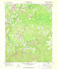
1968 Map of Crab Orchard
USGS Topo · Published 1972About this map
Guyandotte Mountain and the surrounding ridges of the Shady Spring District define this 1968 landscape, where West Virginia's coal and rail economies intersect. The map illustrates a dense network of mountain settlements and industrial sites, including Coal City, Pemberton, and Winding Gulf, many of which were built around active extraction as evidenced by the numerous strip mines and mines tipping operations. Transportation is dominated by the Norfolk and Western and C & O railroads that wind through the valleys of Piney Creek and Beaver Creek. Amidst the industrial terrain, local life is anchored by institutions like Stoco High Sch and Hill Top Ch, while the West Virginia Turnpike cuts across the northern ridges near the Tilden community.
Find a feature on this map
76 named features on this map. Tap any name to fly to it.
Don’t see what you’re looking for? This feature index may not catch every label — zoom into the map to look around manually.
Map Details
Editions of this 1968 Crab Orchard Map
2 editions found
Other maps of this area

1891 · Raleigh
USGS Topo · 1:125,000

1897 · Raleigh
USGS Topo · 1:125,000

1902 · Raleigh
USGS Topo · 1:125,000

1911 · Marshes
USGS Topo · 1:48,000

1911 · Flattop
USGS Topo · 1:48,000

1911 · Beckley
USGS Topo · 1:48,000

1912 · Mullens
USGS Topo · 1:62,500

1913 · Beckley
USGS Topo · 1:62,500

1914 · Eccles
USGS Topo · 1:62,500

1914 · Flattop
USGS Topo · 1:62,500